 Flight Simulation Software
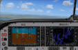

 for Microsoft Flight Simulators FS9 and FSX
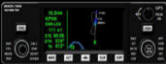
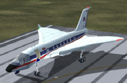
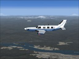
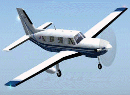
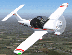
PIPER Meridian. The Malibu Meridian is a low-wing, single-engine turboprop. Its pressurized cabin can accommodate 2 pilots and 4 passengers in club seating. It is powered by a Pratt & Whitney Canada PT6A-42A turbine engine, and can cruise up to 1000 nm at 30,000 feet with a cruising speed of 154 KTAS.
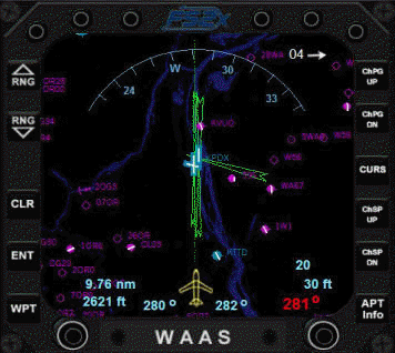
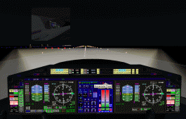
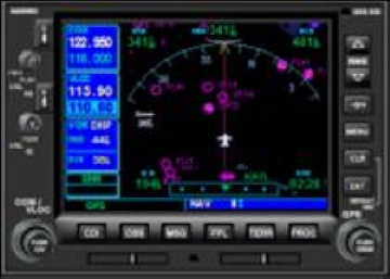
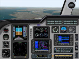
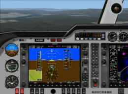
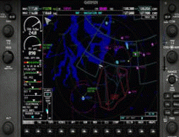
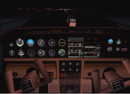
Features of the G1000 version include a Garmin G1000 'glass cockpit', MFD radar traffic, a WAAS GPS unit, an annunciator panel, and a radioaltimeter. Also included are a backup AI, ASI, VOR indicator, and an altimeter. The WAAS, annunciator, and radioaltimeter gauges, as well as an ECU, electrical panel and MFD, are present as popup gauges.
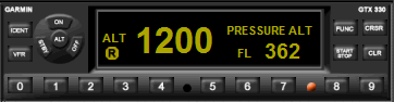
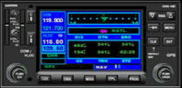
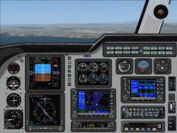
The GC version includes a Garmin G330, G430, G530, S-TEC autopilot, and a GMA340 audio panel.
This package will install the Meridian with the option to use the GC or G1000 panel version. All upgrades to date included. Easy installation and instructions included. No other files required.
by Don Kuhn (original model by Mike Stone) 8.78 MB
PIPER Meridian G1000. The original PoMans Meridian updated with a G1000 glass panel.
Features of the panel include a G1000 'glass cockpit', a WAAS GPS unit, an annunciator panel, and a radioaltimeter. Also included are a backup AI, ASI, VOR indicator, and an altimeter. The WAAS, annunciator, and radioaltimeter gauges, as well as an ECU, electrical panel and MFD, are present as popup gauges.
by Don Kuhn (original model by Mike Stone) 1.87 MB
PIPER Meridian GC. The original PoMans 'glass panel' Meridian.
Features include interior views, a Garmin G330, G430, G530, S-TEC autopilot, radioaltimeter, and a GMA340 audio panel. Custom flight dynamics are included to make this bird fly smoothly and more realistic.
by Don Kuhn (original model by Mike Stone) 1.87 MB
AVIONS Robin 3000. Fully animated pilot. Can be easily seen 'working'. Push/pull/rotatingyoke. Rudder pedals. Usual moving parts. Semi-transparent prop technique. Opening canopy and removable cover reveals the engine. Virtual cockpit. Switchable gauge illumination in VC and 'L' key in spot view. Very nice panel by Matthias Lieberecht. A/C Design and Paint.
by Nick Pike 4.20 MB
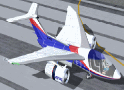
A fictitious Boeing 575-200 (Gmax/FSDS2) with 2 texture sets, demonstrator and private. Animated parts: full pilot, flight controls, spoilers, flaps and slats, lift dumpers, thrust reversers, gear with struts, wheels, suspension, canopy, ailerons, elevators and rudder. Polished aluminum reflective textures.
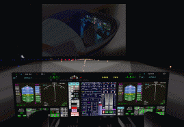
Full lighting with individual switches, including splash effects, logo splash, gear inspection lamps and double flash strobes. True rotating beacon and rain spray. Editable registration number. Auto smoke, wing mist and wingtip contrails. 3D views and DVC with real gauge illumination. Full original XML panel, mostly CRT touchscreen technology (mouse).
XML original gauges including auto features (examples, auto take-off and landing). Panel sounds. Integrated CRT pop-up windows, including GPS, Radios with memory banks, clock/timer/alarm, fuel computers, selectors and fuel dump, day/night HUDs, AIRadar.
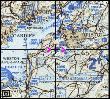
Also XML moving sectional chart gauge for the UK. Complete sound set. See C26_Readme text for full details.
by Nick Pike 28.7MB

Fictitious BAE Systems C4-SST (Super Sonic Transport) (Gmax/FSDS2). An update to enable FS2004 features. Full XML panel and VC with true illuminated gauges.
Additions include two pax doors, one without steps to allow gate docking, rain spray, engine hours, two liveries (American Airlines and original IAT), full lighting and effects. Also XML moving sectional chart gauge for the UK. Original stereo engine sound set included. SeeC4SSTv3_Readme text for full details.
by Nick Pike 21.7 MB